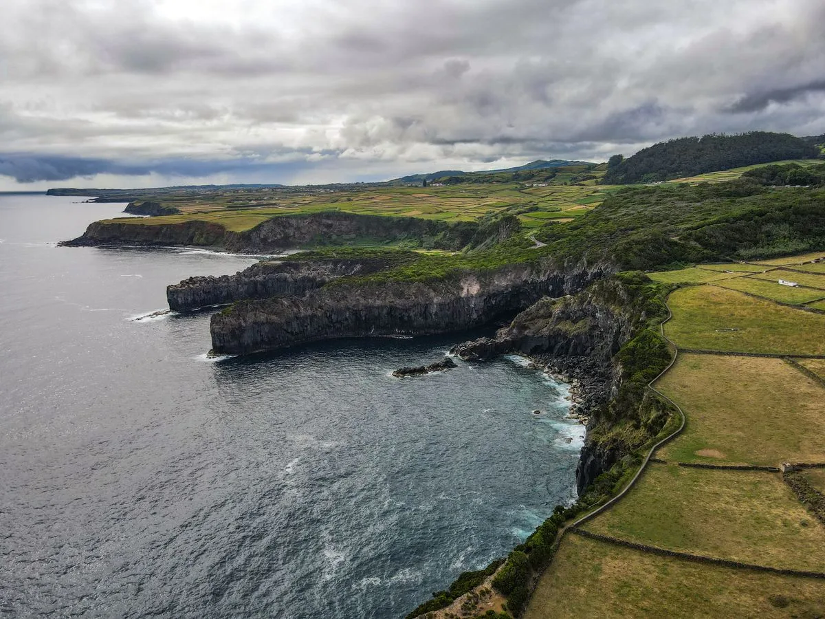
The Azores are the stop most Atlantic crossing crews skip, and most shouldn't. Nine Portuguese volcanic islands sit roughly 1,400 km west of the mainland, close enough to the rhumb line between Europe and the Caribbean that a pause costs a day or two of detour. The reward is real provisioning, real harbours, and the highest mountain in Portugal to climb while the weather sorts itself out.
The catch is the weather itself. The islands sit where Atlantic systems collide, and a clear morning can turn to rain by afternoon in any season. According to Geeky Explorer, written by a São Miguel native, the most stable window runs June through September, with July and August the sunniest months — and even then you pack the rain jacket. Plan stops, not schedules.
For anyone weighing the archipelago against other destinations on a season's route, the honest comparison is with nowhere else. It is not the Mediterranean, and it is not the Caribbean. It is a mid-Atlantic waypoint that behaves like a small country: three island groups spread over more than 600 km of ocean, an autonomous region of Portugal, and a working infrastructure of harbours, chandleries and flights that exists because the islands have served as a waypoint for traffic between Europe and North America for a century.
Which islands matter to a passing crew?
The nine islands fall into three groups. The eastern group holds São Miguel, the largest and most populated island, and Santa Maria. The central group — Terceira, Graciosa, São Jorge, Pico and Faial — is where most cruising concentrates. Flores and Corvo sit alone to the west, closer to North America than to Lisbon in sailing terms. For a crossing boat, the central group is the practical stop; São Miguel is the logistics stop, with the biggest city, Ponta Delgada, and the widest range of services.
Horta, on Faial, is the island sailors know by name. The legislative capital of the region, it has long been the traditional pause point on transatlantic passages, and the marina walls carry the painted names and dates of crews who stopped there — a record kept by the crews themselves, one mural at a time. Angra do Heroísmo on Terceira, the judicial capital, offers a second substantial harbour on the other side of the central group. This connects to our earlier piece, The Ionian in a week: flat-water Greece for cautious crews.
São Miguel rewards a longer stay than a passage allows. The island has crater lakes, geothermal pools warm enough to swim in, and the Furnas valley, where hot steam rises straight from the ground and a stew is cooked underground by the heat itself. If your route allows a week rather than two days, it is worth the detour south.
What does the weather actually do?
The climate is mild year-round, moderated by the Gulf Stream: daytime temperatures normally sit between 16 and 25 °C depending on season, and extremes above 30 °C or below 3 °C are unknown in the main population centres. That mildness is the good news. The complicating news is variability — the islands sit in the middle of the North Atlantic, where weather systems meet, and conditions can change within a day.
The practical read for a crew: treat forecasts as short-term instruments. The same source that names June through September as the stable window also advises checking real-time conditions before committing to a day's plan, and building alternate plans as a matter of course. In a passage-planning sense, the Azores are a place you stop to wait out a system, not a place you push through on a timetable.
Provisioning and what the islands grow
This is where the stop earns its place on the route. The main industries are agriculture, dairy farming, livestock, fishing and tourism, which means the provisioning is local in a way few mid-ocean stops can match: beef and dairy from the island herds, fish from the island waters, and produce grown in volcanic soil. Pineapples grown in greenhouses around Ponta Delgada and the tea plantations of São Miguel — Europe's only commercial tea, locals will tell you — are the details provisioning crews remember.
Provisioning depth varies by island. Ponta Delgada is the full-service stop. Horta and Angra cover the essentials well enough to restock for a crossing. Flores and Corvo are destinations, not depots. If you are staging for the Caribbean run, do the serious shopping in the eastern and central groups and treat the western islands as a weather-window bonus.
Volcano hikes and what to do between weather windows
The islands are volcanic throughout, and the walking is the reason many crews extend their stay. Mount Pico, on the island of Pico, is the highest point in Portugal at 2,351 metres — and if measured from its base on the ocean floor to its summit, it ranks among the tallest mountains on the planet. The climb is a full day and deserves respect, but it is the signature hike of the archipelago.
Faial offers a different kind of walk: the Capelinhos volcano, where you can cross lava fields left by the 1957 eruption — a landscape the local writing describes, not inaccurately, as apocalyptic. São Jorge has steep-sided ridges and coastal fajãs; Flores has crater lakes and waterfalls in a compressed space. On São Miguel, the thermal pools scattered across the islands are warm enough to swim in year-round, which is its own kind of recovery day after a long passage.
Our analysis: the hiking is not a side activity here. For crews waiting on a weather window, it is the reason the wait feels like part of the holiday rather than a delay. The archipelago markets itself on exactly this — the official tourism portal, Visit Azores, lists hiking, whale watching and yachting among its headline experiences and positions the islands as a sustainability-first destination.
How the Azores fit a crossing season
Eastbound boats from the Caribbean typically arrive in late spring; westbound boats from Europe stage through the islands in early summer before the trade-wind season. The mild temperatures mean the stop never closes, but the June-to-September stability window is when the inter-island hops — which otherwise involve real open-ocean legs of 100 nautical miles and more — become comfortable rather than sporty.
Inter-island travel by air is possible but, as local guidance puts it, not easy or cheap, so plan the island sequence before you arrive rather than improvising it from the water. A common mistake first-time visitors make ashore applies equally afloat: trying to see too many islands in one stop. The advice from those who know the place is to go slow; the islands reward that, and the passage calendar usually allows it if you planned the stop in from the start.
For crews building a full season rather than a single passage, the Azores pair naturally with a European spring — the flat-water Ionian in a week or a Dalmatian coast season — before pointing west. And once the crossing is done, the British Virgin Islands circuit is the classic first week of the Caribbean half. The Azores are the hinge between the two halves, and the piece of the route most likely to become the story you tell afterwards. Readers following this should also see The British Virgin Islands in seven days: a circuit that still works.
What the evidence leaves open
Two things remain unknown from the available reporting, and both matter to planning. Berth availability and marina pricing by season are not documented in the material reviewed here — ask the marinas directly and date the answers. And while the islands' history is well established (settled under Portuguese direction in the 1400s, with settlement recorded from 1432), the specific services each harbour offers a visiting yacht change year to year. Treat this guide as the shape of the stop; treat the harbour sheet as the detail.